
National parks / Biscayne National Park
Biscayne National Park
National Park · FL · nps.gov →
About the park
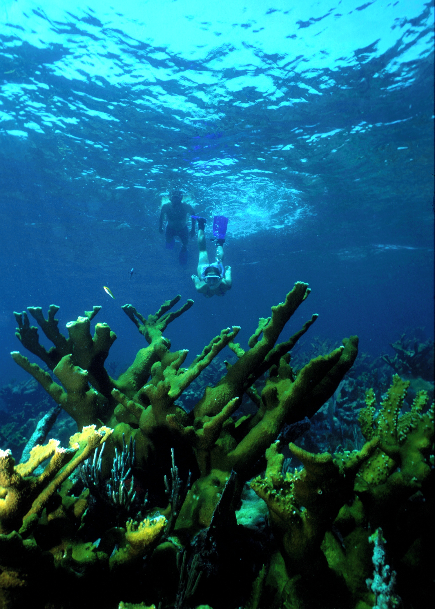
Within sight of Miami, yet worlds away, Biscayne protects a rare combination of aquamarine waters, emerald islands, and fish-bejeweled coral reefs. Evidence of 10,000 years of human history is here too; from prehistoric tribes to shipwrecks, and pineapple farmers to presidents. For many, the park is a boating, fishing, and diving destination, while others enjoy a warm breeze and peaceful scenery.
The Park Service's own description.
Weather, in the Park Service's words
The park is situated in a subtropical climate, which ensures sunshine year-round. Winters are normally dry and mild, with occasional fronts bringing wind and little rain. Summer brings hot and humid weather with scattered thunderstorms in the afternoons. The average temperature in January is 68 degrees Fahrenheit and 82 in July. The average rainfall for the area is 2.17 inches in January and 3.95 inches in July. June to November is hurricane season.
Getting there
The Dante Fascell Visitor Center may be reached from the Florida Turnpike by taking Exit 6 (Speedway Boulevard). Turn left from exit ramp and continue south to SW 328th Street (North Canal Drive). Turn left on 328th Street and continue for four miles to the end of the road. The park entrance is on the left just before the entrance to Homestead Bayfront Marina.
Hours
Launch your own canoe or kayak from the ramp near the parking area, enjoy a picnic on the lawn, or stroll along the jetty trail.
Current alerts (4)
Park Closure · Adams Key Closed
Adams Key closed due to structural fire — Effective November 7, 2026, Adams Key, including its docks, is closed to all public use for visitor safety. Other park area remain open.
Information · Camping and Docking at Boca Chita and Elliott Keys
Day Use Docking at Boca Chita and Elliott Keys: $25.00 Friday - Monday and Federal Holidays. Overnight Camping and Docking at Boca Chita and Elliott Keys: $60.00 per night. Payments must be made on site using the recreation.gov phone app.
Information · Ride Share Services
Convoy Point grounds, Jetty Trail, kayak launch, and picnic area open at 7 a.m. and close at 5:30 p.m. If you are using a ride share service for transportation to and from the park, ensure ride share services can be onsite before closing time.
Caution · Boater Awareness
Please use caution in park waters due to navigational markers that may be missing or moved due to unforeseen circumstances.
Camp index at the park
Now 76°F, feels like 78°F; tonight's low about 77°F; UV 0.
- Breezy (16 mph): a windscreen for the stove
- Tonight's low about 77°F: a summer bag or a quilt
Forecast for the park's reference point; valleys and ridges differ by thousands of feet. How the index works →
Campgrounds in the park (2)
Around the park
Camp set up before "dark by" is the rule most people learn once. Source: sunrise-sunset.org.
- Elliot Key Campground · 3 mi · reservable on Recreation.gov
- Boca Chita Campground · 3 mi · reservable on Recreation.gov
Recreation.gov (RIDB): national forests, parks, BLM and Corps of Engineers sites with camping. State parks book through the state; the near-you pages list the rest from OpenStreetMap.
| Gauge | Flow | Stage |
|---|---|---|
| 10B BLACK CREEK CANAL AT OLD CUTLER RD NR GOULDS 10 mi | – | 0.29 ft |
| BLACK CREEK CANAL EAST OF US1 NR GOULDS 12 mi | 12.4 cfs | 0.31 ft |
| SW 122 AVE CANAL AT SW 208TH ST NR GOULDS 12 mi | – | 1.37 ft |
| SW 122 AVE CANAL AT SW 202ND ST NR GOULDS 13 mi | – | 1.31 ft |
| BLACK CREEK CANAL WEST OF 127 AVE NR GOULDS 13 mi | -12 cfs | 2.58 ft |
| SNAPPER CREEK NO.5 ABV WATER PIPE NR S. MIAMI 17 mi | 434 cfs | 2.86 ft |
Discharge in cubic feet per second and gage height, from the USGS instantaneous-values service, usually within the hour. What a number means for wading or paddling depends on the river; the gauge page has the long-term median to compare against, and a sharp rise after rain is the sign to stay out.
NOAA CO-OPS predictions, local time, feet above MLLW. Launch and land on a rising tide where there are mudflats; the station page has the full table.
Tents in the shop
All tents → Made in the USA






Park text, alerts, campgrounds and images are the National Park Service's (public domain), fetched through its API; weather from MET Norway, alerts from the NWS, air quality from the EPA, fires from the interagency WFIGS feed, rivers from the USGS, tides from NOAA. Trail & Lantern adds the camp index and nothing else; none of this is safety advice. Check with the ranger station before you go.