
National parks / Crater Lake National Park
Crater Lake National Park
National Park · OR · nps.gov →
About the park
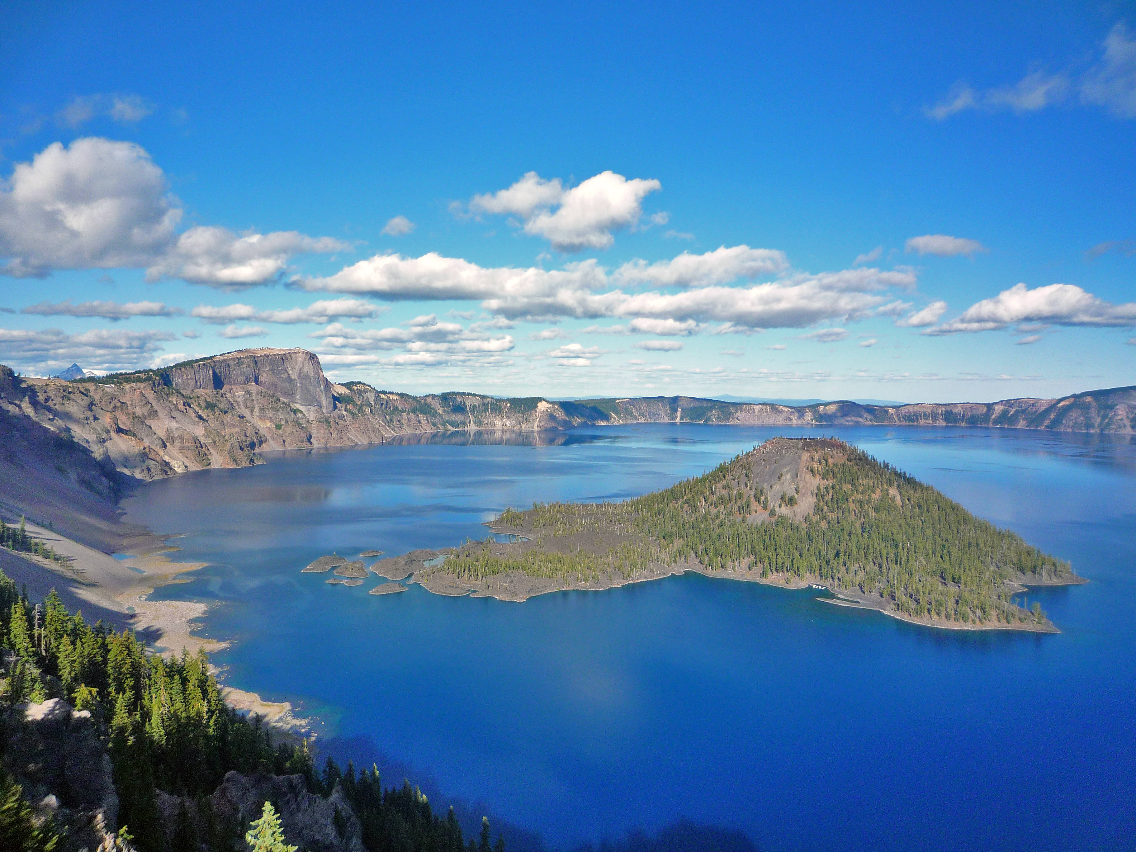
Crater Lake inspires awe. Native Americans witnessed its formation 7,700 years ago, when a violent eruption triggered the collapse of a tall peak. Scientists marvel at its purity—fed by rain and snow, it’s the deepest lake in the USA and one of the most pristine on Earth. Artists, photographers, and sightseers gaze in wonder at its blue water and stunning setting atop the Cascade Mountain Range.
The Park Service's own description.
Weather, in the Park Service's words
July, August, and September are your best bets for warm, dry weather. In May, June, and October, sunny days alternate with periods of rain and snow. Winters at Crater Lake are long and snowy. Storms from the Pacific Ocean dump an annual average of 41 feet (13.5 meters) of snow at park headquarters. When it's raining or snowing, the lake is usually hidden by clouds. Crater Lake is completely invisible about 50% of the time in the winter!
Getting there
From the west (Medford) - Take Hwy 62 to the West Entrance. Open year-round. From the south (Klamath Falls) - Take Hwy 97 north to Hwy 62 to the South Entrance. Open year-round. The North Entrance is on Hwy 138 and is accessed from Interstate 5 east at Roseburg or Hwy 97 south from Bend and Chemult. Winter travelers from Roseburg take Route 138 east to Route 230 south to Route 62 east to the park's west entrance. Travelers from Bend take Route 97 south to Route 62 to the park's south entrance.
Entrance fees
- Entrance - Private Vehicle: $30.00 · This is the summer entrance fee and is charged from mid-May through the end of October. Admits one private, non-commercial vehicle (15-passenger capacity or less) and all occupants. Good for 7 days.
- Entrance - Private Vehicle: $20.00 · This is the winter entrance fee. Admits one private, non-commercial vehicle (15-passenger capacity or less) and all occupants. Good for 7 days.
- Entrance - Motorcycle: $25.00 · Valid for 7 days. Admits up to 2 private, non-commercial motorcycles with up to 4 total passengers. Summer rate from mid-May to October 31st.
- Entrance - Motorcycle: $15.00 · Valid for 7 days. Admits up to 2 private, non-commercial motorcycles with up to 4 total passengers. Winter rate from 11/1 through mid-May.
- Entrance - Per Person: $15.00 · Admits one individual with no motor vehicle (bicyclist, hiker, pedestrian). Youth 15 and under are admitted free of charge. Good for 7 days.
- Entrance - Snowmobile: $15.00 · Admits one individual on a snowmobile for travel on snow covered North Entrance Road closed to regular vehicle traffic. Youth 15 and under are admitted free of charge. Good for 7 days.
The America the Beautiful annual pass covers entrance at every park; it does not cover camping.
Hours
Crater Lake National Park is open year-round, 24 hours a day. Some roads, trails, and facilities, however, are closed seasonally due to snow. North Entrance Road, and West and East Rim Drives close for the season on November 1 (or earlier if there is significant snowfall). Crews begin removing snow from these roads in April, but opening dates vary. The North Entrance Road and West Rim Drive tend t
Current alerts (3)
Park Closure · Road to Rim Village is Temporarily CLOSED.
The road from Park Headquarters to Rim Village is temporarily CLOSED due to heavy snow from the current weather system. Roads are very slick and covered with slush. Please use extreme caution if driving in the park. All Oregon snow tire and chain laws apply.
Park Closure · Rim Drive and North Entrance Road are CLOSED for the Season.
Winter road closures are in effect. The park's North Entrance Road, most of the Rim Drive, Cloudcap, and Pinnacles Road are closed to automobiles. The park's West and South Entrances are open, as is Hwy 62 through the park. These roads will not reopen until mid-June or early July…
Park Closure · Cleetwood Cove Trail is CLOSED for Rehabilitation
The Cleetwood Cove Trail is CLOSED for construction. This critical project will fully rehabilitate the trail and marina to ensure safe access to the lake, provide a much-improved visitor experience, and protect the environment. more →
Camp index at the park
Now 33°F, feels like 31°F; tonight's low about 24°F; UV 0.2.
- 33°F: cold; a 30°F bag and a pad with real insulation (R-value 3 or more)
- Showers possible: stake the fly out before dark
- Tonight's low about 24°F, 0.3 mm of rain overnight: a 20°F bag or warmer
Forecast for the park's reference point; valleys and ridges differ by thousands of feet. How the index works →
Campgrounds in the park (2)
Around the park
Camp set up before "dark by" is the rule most people learn once. Source: sunrise-sunset.org.
- Crater Lake Lodge · 4 mi · first come, first served or not reservable online
- BROKEN ARROW CAMPGROUND · 13 mi · reservable on Recreation.gov
- SOUTH SHORE PAVILION · 14 mi · reservable on Recreation.gov
- HEMLOCK CABIN · 14 mi · reservable on Recreation.gov
- DIAMOND LAKE · 15 mi · reservable on Recreation.gov
- THIELSEN VIEW CAMPGROUND · 16 mi · reservable on Recreation.gov
- IMNAHA GUARD STATION · 19 mi · reservable on Recreation.gov
- JIM CREEK GROUP CAMPGROUND · 20 mi · reservable on Recreation.gov
- LODGEPOLE GUARD STATION · 23 mi · reservable on Recreation.gov
Recreation.gov (RIDB): national forests, parks, BLM and Corps of Engineers sites with camping. State parks book through the state; the near-you pages list the rest from OpenStreetMap.
Tents in the shop
All tents → Made in the USA






Park text, alerts, campgrounds and images are the National Park Service's (public domain), fetched through its API; weather from MET Norway, alerts from the NWS, air quality from the EPA, fires from the interagency WFIGS feed, rivers from the USGS, tides from NOAA. Trail & Lantern adds the camp index and nothing else; none of this is safety advice. Check with the ranger station before you go.