
National parks / Grand Canyon National Park
Grand Canyon National Park
National Park · AZ · nps.gov →
About the park
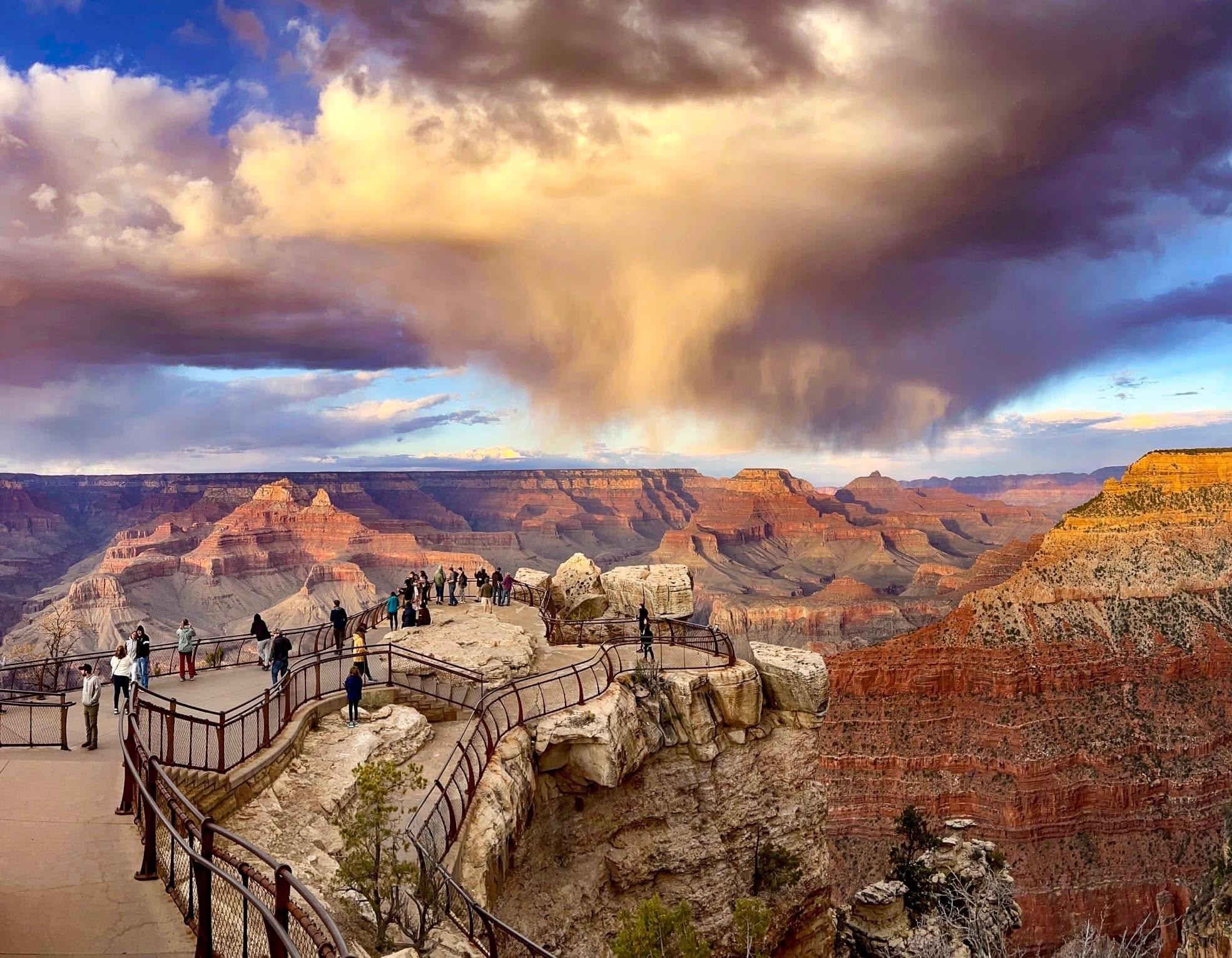
Entirely within the state of Arizona, the park encompasses 278 miles (447 km) of the Colorado River and adjacent uplands. Located on the ancestral homelands of 11 present day Tribal Communities, Grand Canyon is one of the most spectacular examples of erosion anywhere in the world—a mile deep canyon unmatched in the incomparable vistas it offers visitors from both north and south rims.
The Park Service's own description.
Weather, in the Park Service's words
Since Grand Canyon has elevations that range from 2,500 feet at the bottom to 8,400 feet on the North Rim, weather can vary significantly depending on the season and the specific location within the park. Winters tend to be cold and snowy, and summers have periods of excessive heat. High temperatures inside the canyon tend to be 20 to 30 degrees warmer then on the canyon's rims. Weather conditions can change rapidly, so it's wise to check forecasts before visiting.
Getting there
South Rim: Open all year, is located 60 miles north of Williams, Arizona (via route 64 from Interstate 40) and 80 miles northwest of Flagstaff (via route 180). Grand Canyon lies entirely within the state of Arizona. ---- North Rim: Select areas are open to public access between Oct 1 and Nov 14. View the park's news releases for details. The North Rim entrance station is located 30 miles south of Jacob Lake, AZ, on Highway 67; the actual rim of the canyon is an additional 14 miles south.
Entrance fees
- Entrance - Private Vehicle: $35.00 · Admits one single, private, non-commercial vehicle and all its passengers, up to a 15 person passenger van. Organized non-commercial groups over 16 passengers require different charges. Commercial groups are not eligible for the vehicle permit.
- Entrance - Motorcycle: $30.00 · Valid for 7 days. Admits up to 2 private, non-commercial motorcycles with up to 4 total passengers.
- Entrance - Per Person: $20.00 · Individual ($20 valid for 7 days): for bicyclists, hikers, and pedestrians.
- Nonresident: $100.00 · Each non-US resident aged 16 and older visiting Grand Canyon National Park must pay a $100 nonresident fee (in addition to the standard entrance fee), unless admitted with an Annual or America the Beautiful Pass. This includes nonresidents entering as part of a commercial tour group, commercial use
The America the Beautiful annual pass covers entrance at every park; it does not cover camping.
Hours
Both Desert View (East Entrance) and South Entrance are Open 24 hours/day and 7 Days/week. Credit cards, and America the Beautiful passes are accepted for entry. Cash is not accepted at this time. The South Entrance Station, near Tusayan, Arizona, receives the most traffic, an experiences long lines and up to 2 hour wait times between 9:30 am and 4 pm. The East Entrance at Desert View - 32 miles e
Current alerts (4)
Caution · Overnight Lodging Suspended and Parkwide Stage 4 Water Restrictions
Stage 4 water restrictions continue through Nov. 19, 2026 due to a parkwide water shortage. Overnight lodging is anticipated to resume on Friday, Nov. 20. The park remains open for day use, with food and beverage services, the Grand Canyon Clinic, and Post Office remaining open. … more →
Park Closure · INNER CANYON TRAIL CLOSURES
Current trail closures: the entire North Kaibab Trail (including Cottonwood Campground), Phantom Ranch, Bright Angel Campground, Silver Bridge, and the Black Bridge. Please do not attempt to access the closed areas. Beginning Nov. 18, intermittent trail delays will occur just abo…
Danger · INNER CANYON WATER SHUTOFFS
Beginning Sep. 6, no potable water will be available in the inner canyon, including along the Bright Angel Trail (1.5 Mile Resthouse, 3-Mile Resthouse, Havasupai Gardens day use and campground). All backpackers and hikers should carry water filtration and treatment OR carry all w… more →
Caution · Critical Backcountry Updates/Closures
Visit this link for the inner canyon weather forecast, current trail closures, today's heat risk, and drinking water availability. more →
Camp index at the park
Now 51°F, feels like 51°F; tonight's low about 33°F; UV 0.3.
- Nothing in the forecast argues against a tent tonight
- Tonight's low about 33°F: a 30°F bag
Forecast for the park's reference point; valleys and ridges differ by thousands of feet. How the index works →
Campgrounds in the park (3)
Around the park
Camp set up before "dark by" is the rule most people learn once. Source: sunrise-sunset.org.
- Tusayan Ranger District · 1 mi · first come, first served or not reservable online
- MATHER CAMPGROUND · 3 mi · reservable on Recreation.gov
- Tusayan - Montane · 4 mi · reservable on Recreation.gov
- HULL CABIN · 10 mi · reservable on Recreation.gov
- North Rim Campground (AZ) · 15 mi · reservable on Recreation.gov
Recreation.gov (RIDB): national forests, parks, BLM and Corps of Engineers sites with camping. State parks book through the state; the near-you pages list the rest from OpenStreetMap.
| Gauge | Flow | Stage |
|---|---|---|
| PUMP HOUSE WASH SPRING NEAR GRAND CANYON 5 mi | 0.16 cfs | 0.3 ft |
| COLORADO RIVER NEAR GRAND CANYON 7 mi | 9,110 cfs | 15.46 ft |
| BRIGHT ANGEL CREEK NEAR GRAND CANYON, ARIZ. 8 mi | 18.9 cfs | 12.26 ft |
| HERMIT CREEK ABOVE TONTO TRAIL NR GRAND CANYON 8 mi | 1.6 cfs | 0.44 ft |
| BRIGHT ANGEL CREEK BELOW RIBBON FALLS IN GCNP 11 mi | – | 15.3 ft |
| BRIGHT ANGEL CR BLW COTTONWOOD CAMPGD IN GCNP 12 mi | – | 10.42 ft |
Discharge in cubic feet per second and gage height, from the USGS instantaneous-values service, usually within the hour. What a number means for wading or paddling depends on the river; the gauge page has the long-term median to compare against, and a sharp rise after rain is the sign to stay out.
Tents in the shop
All tents → Made in the USA






Park text, alerts, campgrounds and images are the National Park Service's (public domain), fetched through its API; weather from MET Norway, alerts from the NWS, air quality from the EPA, fires from the interagency WFIGS feed, rivers from the USGS, tides from NOAA. Trail & Lantern adds the camp index and nothing else; none of this is safety advice. Check with the ranger station before you go.