
National parks / Hawaiʻi Volcanoes National Park
Hawaiʻi Volcanoes National Park
National Park · HI · nps.gov →
About the park
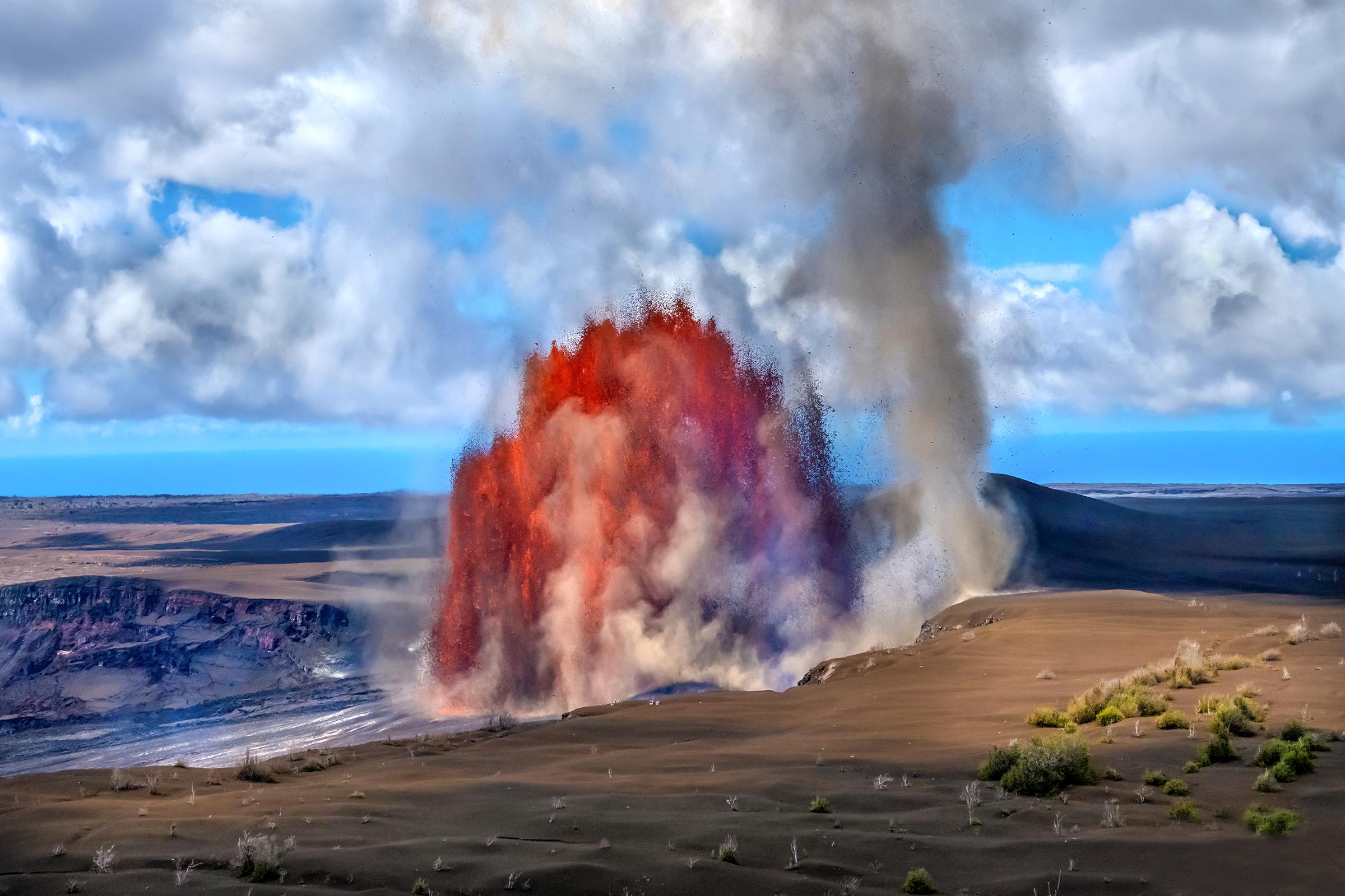
Hawai‘i Volcanoes National Park protects some of the most unique geological, biological, and cherished cultural landscapes in the world. Extending from sea level to 13,680 feet, the park encompasses the summits of two of the world's most active volcanoes - Kīlauea and Mauna Loa - and is a designated International Biosphere Reserve and UNESCO World Heritage Site.
The Park Service's own description.
Weather, in the Park Service's words
The weather the summit of Kīlauea (~4000' elevation) varies daily and may be rainy and chilly any time of the year. Temperature varies by elevation. At the summit of the volcano, temperatures may be 12 to 15 degrees cooler than at sea level. The coastal plain at the end of Chain of Craters Road is often hot, dry, and windy with the possibility of passing showers.
Getting there
Hawai‘i Volcanoes National Park is located on the Island of Hawai‘i. From Hilo: 30 miles southwest on Highway 11 (45 minute drive); from Kailua-Kona: 96 miles southeast on Highway 11 (2 to 2.5 hour drive), or 125 miles through Waimea and Hilo via Highways 19 and 11 (2.5 to 3 hours).
Entrance fees
- Entrance - Private Vehicle: $30.00 · Private Vehicle Pass - The private vehicle pass admits the passholder and up to 14 passengers of a single, private (non-commercial) vehicle.
- Entrance - Motorcycle: $25.00 · Valid for 7 days. Admits up to 2 private, non-commercial motorcycles with up to 4 total passengers.
- Entrance - Per Person: $15.00 · Pedestrian/Cyclist Pass - Admits one individual bicyclist, hiker, or pedestrian visiting without a private vehicle. An individual pass is not required for visitors aged 15 and under.
- Commercial Entrance - Mini-bus: $100.00 · The commercial entrance fee for a Road Based Guided Tour is based on vehicle seating capacity. For a 16-25 passenger vehicle the user fee is $100.
- Commercial Entrance - Motor Coach: $200.00 · The commercial entrance fee for a Road Based Guided Tour is based on vehicle seating capacity. For a 26+ passenger vehicle the user fee is $200. Large vehicles, defined as more than 26 feet in length and/or more than eight feet wide, are only allowed to operate on Crater Rim Drive to Kilauea Visit
- Commercial Entrance - Per Person: $15.00 · $15 per person for Commercial Non-Road Based Guided Tours. This includes hiking more than one mile on one trail, bird watching on foot for more than one hour at one location, and/or or bicycling tours.
The America the Beautiful annual pass covers entrance at every park; it does not cover camping.
Hours
Hawai‘i Volcanoes National Park is open 7 days a week, 24 hours a day including holidays.
Current alerts (6)
Park Closure · Hilina Pali Road Partial Closure Beyond Maunaiki Trailhead
Hilina Pali Road from the Maunaiki Trailhead to the lookout is closed to all use motorized vehicles from 6 a.m. to 4:30 p.m. Monday through Thursday for shoulder work. Hikers, bicyclists and backcountry permit holders will be given access but should expect delays while heavy mach…
Danger · Kīlauea eruption
Volcanic eruptions can be hazardous. Stay out of closed areas and monitor air quality. Eruptions can last a few hours and are often separated by pauses lasting several weeks. more →
Caution · Kīpukapuaulu Trail Closed Due to Hazardous Trees and Hanging Limbs
Kīpukapuaulu Trail remains closed due to numerous hazardous trees and hanging limbs resulting from several recent storms. Managers are developing a plan and will reopen the trail when it is safe.
Information · Sulphur Banks Bridge Closed; Boardwalk is Open
The Sulphur Banks Bridge is damaged and closed until further notice. The Haʻakulamanu area, boardwalk and Sulphur Banks Trail are open and accessible from the west side near Steam Vents.
Information · Upper Kahuku Road Closed Beyond Boot Decontamination Station
Upper Kahuku Road remains closed beyond the boot decontamination station due to storm damage. The Visitor Contact Station and most trails in the Kahuku Unit are now open following Hurricane Lala. Kahuku Road above the Lower Palm Trailhead is deeply rutted by the recent heavy rain…
Caution · Protect Yourself from Volcanic Tephra
Volcanic ash, rock and glassy strands (tephra) is present at Kīlauea summit and can irritate your skin, eyes and respiratory system. For your safety, do not handle it. Eye protection, long sleeves, long pants, a hat, closed-toe shoes and a dust mask are recommended.
Camp index at the park
Now 71°F, feels like 71°F; tonight's low about 58°F; UV 7.6.
- Wind 21 mph: stake and guy the tent, stove behind a windscreen, no open fire in dry country
- UV 8: high; shade at midday
- Tonight's low about 58°F: a summer bag or a quilt
Forecast for the park's reference point; valleys and ridges differ by thousands of feet. How the index works →
Campgrounds in the park (2)
Around the park
Camp set up before "dark by" is the rule most people learn once. Source: sunrise-sunset.org.
| Gauge | Flow | Stage |
|---|---|---|
| Paauau Gulch at Pahala 9 mi | – | 2.98 ft |
| Wailuku River nr Kaumana 30 mi | 4.98 cfs | 1.14 ft |
| Wailuku River at Piihonua 33 mi | 105 cfs | 3.01 ft |
| Honolii Stream nr Papaikou 36 mi | 49.3 cfs | 2.72 ft |
| Waiaha Stream at Holualoa 37 mi | 0 cfs | 0.89 ft |
| Waikaumalo Stream at Hwy 19 Bridge 46 mi | – | 4.32 ft |
Discharge in cubic feet per second and gage height, from the USGS instantaneous-values service, usually within the hour. What a number means for wading or paddling depends on the river; the gauge page has the long-term median to compare against, and a sharp rise after rain is the sign to stay out.
NOAA CO-OPS predictions, local time, feet above MLLW. Launch and land on a rising tide where there are mudflats; the station page has the full table.
Tents in the shop
All tents → Made in the USA






Park text, alerts, campgrounds and images are the National Park Service's (public domain), fetched through its API; weather from MET Norway, alerts from the NWS, air quality from the EPA, fires from the interagency WFIGS feed, rivers from the USGS, tides from NOAA. Trail & Lantern adds the camp index and nothing else; none of this is safety advice. Check with the ranger station before you go.