
National parks / Indiana Dunes National Park
Indiana Dunes National Park
National Park · IN · nps.gov →
About the park
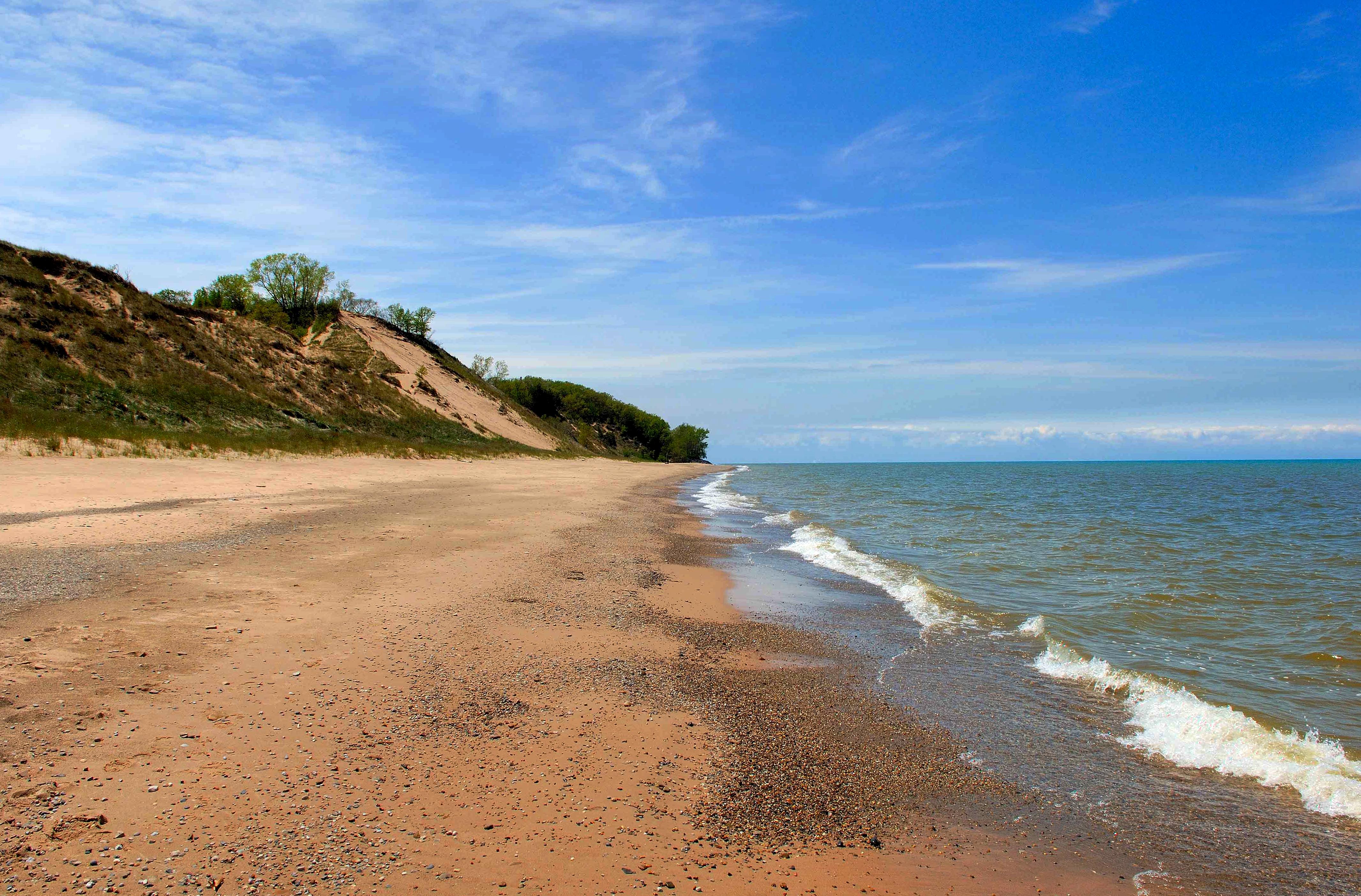
Lake Michigan's might has influenced Indiana Dunes for millennia. Wind and waves have shaped the land, leaving a rich mosaic of habitats along these 15 miles of Indiana coast. Over 50 miles of trails lead through shifting sand dunes, quiet woodlands, sunny prairies and lush wetlands. Known for its striking plant and bird diversity, it's easy to find inspiration throughout the park’s 16,000 acres.
The Park Service's own description.
Weather, in the Park Service's words
On average, the warmest month is July and the highest recorded temperature was 105F in 1934. The coolest month is January, with the lowest recorded temperature of -25F in 1985. June sees the most precipitation with an average rainfall of 4.66 Inches.
Getting there
Visitors can access the national park via Interstate 94, the Indiana Toll Road (Interstate 80/90), U.S. Highway 12, U.S. Highway 20, Indiana State Road 49, and various other local roads. The Indiana Dunes Visitor Center is located on Indiana State Road 49, between U.S. Highway 20 and Interstate 94 (1215 IN-49, Porter, IN 46304). For a driving map to the Indiana Dunes Visitor Center or other locations, check out our maps page.
Entrance fees
- Entrance - Motorcycle: $20.00 · Valid for 7 days. Admits up to 2 private, non-commercial motorcycles with up to 4 total passengers.
- Entrance - Private Vehicle: $25.00 · 7-Day Park Entrance Fee - Family-Size Vehicle Per private family-sized vehicle (valid for 1-7 days from date of purchase).
- Entrance - Per Person: $15.00 · 7-Day Per Person Entrance Fee (Organized, non-commercial groups) Visitors 16 years of age or older who enter on foot, bicycle, boat, or as part of an organized group not involved in a commercial tour.
- Commercial Entrance - Sedan: $25.00 · Entry for commercial sedans with 6 or less people. Cost is $25.00 plus $15 per person (not to exceed next highest rate).
- Commercial Entrance - Van: $40.00 · Commercial Tour Fee - Van (7-15 persons) - $40.00 Entry for commercial vans with 7-15 people.
- Commercial Entrance - Mini-bus: $40.00 · Commercial Tour Fee - Mini Bus (16-25 persons) - $40.00 Entry for commercial mini bus with 16-25 people.
The America the Beautiful annual pass covers entrance at every park; it does not cover camping.
Hours
The general areas of the park are open year-round. Please check individual areas for specific hours of operation.
Current alerts (9)
Park Closure · Partial Trail Closures on Bailly / Chellberg Trail
Portions of Bailly / Chellberg Trail (with stairs) will be closed through October (10/30/26), to allow completion of boardwalk replacement project.
Park Closure · Partial Trail Closure - Dunewood Trace
Partially open. Persistent flooding west of the campground currently limits access to the entire trail. Hikers may not always be able to traverse the full length.
Park Closure · Closure - Hobart Woodland Trail
Closed. The Woodland Trail is closed indefinitely, and no reopening date is available. However, the paved Oak Savannah Trail remains open.
Park Closure · Partial Closure - Upland Trail
The middle boardwalk was lost due to a tree strike, making the full loop inaccessible. At this time, there is no timeline for replacement.
Park Closure · Closure - Heron Rookery Trail
Closed. The trail is undergoing tree removal and rerouting due to riverbank collapse. It is expected to reopen in the fall, after mosquito activity decreases.
Information · Other Park Conditions and Updates
For more information on storm related repairs and other park conditions like beach and hiking safety visit our park status page. more →
Caution · Water Safety Alert
After recent storms, E. coli levels are likely to reach above safe swimming standards. Entering the water after heavy rainfall is never recommended. Know before you go and always check our Beach Safety page before heading to park beaches. more →
Park Closure · Partial Closures to Little Calumet River Trail and Glenwood Dunes Trail
Marquette Greenway construction will require closing sections of the Glenwood Dunes Trail (April–December 2026) and Little Calumet River / Mnoké Prairie Trail (May–December 2026). Closure dates may shift as work progresses. Please follow all posted closures and check the park web… more →
Camp index at the park
Now 43°F, feels like 42°F; tonight's low about 34°F; UV 0.
- 43°F: cold; a 30°F bag and a pad with real insulation (R-value 3 or more)
- Tonight's low about 34°F: a 30°F bag
Forecast for the park's reference point; valleys and ridges differ by thousands of feet. How the index works →
Campgrounds in the park (3)
Around the park
Camp set up before "dark by" is the rule most people learn once. Source: sunrise-sunset.org.
- Dunbar Group Site · 6 mi · reservable on Recreation.gov
- Dunewood Campground · 6 mi · reservable on Recreation.gov
- Central Avenue Walk-in Sites · 9 mi · reservable on Recreation.gov
Recreation.gov (RIDB): national forests, parks, BLM and Corps of Engineers sites with camping. State parks book through the state; the near-you pages list the rest from OpenStreetMap.
Tents in the shop
All tents → Made in the USA






Park text, alerts, campgrounds and images are the National Park Service's (public domain), fetched through its API; weather from MET Norway, alerts from the NWS, air quality from the EPA, fires from the interagency WFIGS feed, rivers from the USGS, tides from NOAA. Trail & Lantern adds the camp index and nothing else; none of this is safety advice. Check with the ranger station before you go.