
National parks / Mount Rainier National Park
Mount Rainier National Park
National Park · WA · nps.gov →
About the park
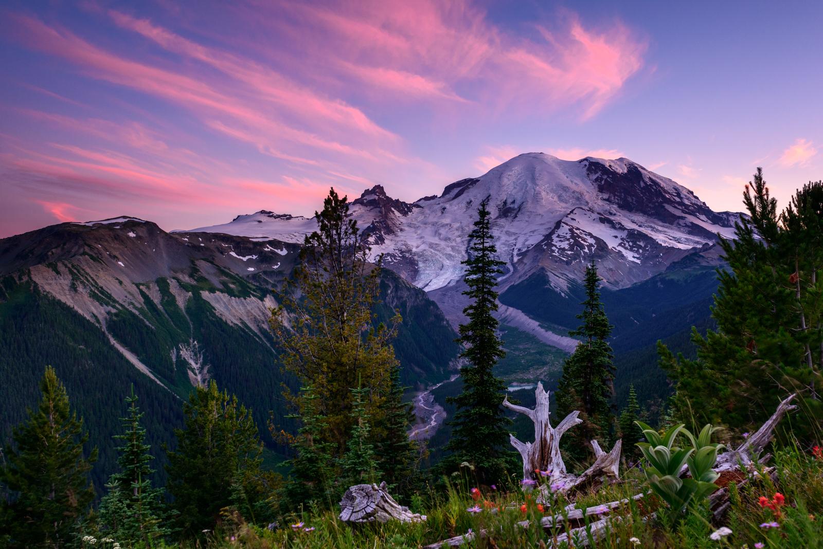
Ascending to 14,410 feet above sea level, Mount Rainier stands as an icon in the Washington landscape. An active volcano, Mount Rainier is the most glaciated peak in the contiguous U.S.A., spawning five major rivers. Subalpine wildflower meadows ring the icy volcano while ancient forest cloaks Mount Rainier’s lower slopes. Wildlife abounds in the park’s ecosystems. A lifetime of discovery awaits.
The Park Service's own description.
Weather, in the Park Service's words
Weather patterns at Mount Rainier are strongly influenced by the Pacific Ocean and elevation. The climate is generally cool and rainy, with summer highs in the 60s and 70s. While July and August are the sunniest months of the year, rain is very likely in spring, fall, and winter. Visitors should be aware that mountain weather is very changeable. In the higher elevations, like Paradise, winter can last from November to May with many feet of snow on the ground.
Getting there
Mount Rainier National Park is located in west-central Washington state. Several major cities in Washington- Seattle, Tacoma, and Yakima- and Portland, Oregon, are within 200 miles of the park. For GPS to Nisqually Entrance use: 39000 State Route 706 E, Ashford, WA 98304.
Entrance fees
- Entrance - Private Vehicle: $30.00 · Grants unlimited entry for one vehicle and passengers for seven consecutive days. Vehicle must be private, noncommercial, and with a seating capacity of 15 or less.
- Entrance - Per Person: $15.00 · Walk-up or single bicycle fee. Grants unlimited entry for seven consecutive days.
- Entrance - Motorcycle: $25.00 · Valid for 7 days. Admits up to 2 private, non-commercial motorcycles with up to 4 total passengers.
- Commercial Entrance - Mini-bus: $100.00 · These fees are charged only to commercial organizations, such as tour companies. This fee is determined by the seating capacity of the vehicle.
- Commercial Entrance - Motor Coach: $200.00 · These fees are charged only to commercial organizations, such as tour companies. This fee is determined by the seating capacity of the vehicle. NOTE: There are no current road restrictions for unmodified motor coaches of the standard length in the park. However, be aware that roads in the park are s
The America the Beautiful annual pass covers entrance at every park; it does not cover camping.
Hours
Mount Rainier National Park is open all year. Visitation peaks in July and August with warmer weather and blooming wildflowers. In spring and autumn, weather determines the availability of facilities and roads. During winter months a number of roads, facilities, and entrances close for the season.
Current alerts (7)
Park Closure · Paradise Road Status: Open, tire chains required, gate closing at 3 pm.
11/15/2026 The road is open to Paradise. All vehicles, including 4WD and AWD, must carry tire chains and be ready to use them; today, tire chains are required to be used on all 2-wheel drive vehicles beginning 7 miles beyond Longmire and continuing up to Paradise. The gate will c…
Park Closure · Paradise Road Status: Gate closed at Longmire: projected to open tomorrow
11/13/2026: The road is open to Longmire. All vehicles, including 4WD and AWD, must carry tire chains and be ready to use them. The gate at Longmire to Paradise is closed for the night to support public safety and is projected to open, conditions permitting, tomorrow, 11/14/2026 …
Information · Winter Season Closures
The following regular winter season road closures are in place: Westside, Paradise Valley, Ricksecker Point, Stevens Canyon, White River, & Sunrise Roads. Closed roads may be open to bicycling when work is not underway on the road. Always check signs on closed road gates before p… more →
Caution · WILDFIRE CLOSURES: Sunrise & northern trails.
Due to several active fires on the north side of the park, the following closures are in effect until further notice: Grand Park area & trails, Northern Loop Trail, Wonderland Trail from Carbon River Suspension Bridge to Frozen Lake, & associated backcountry campgrounds. White Ri… more →
Information · SR 165 Carbon River/Fairfax Bridge is closed: no access to Carbon River or Mowich Lake.
There is NO public access to Carbon River & Mowich Lake from SR 165. The bridge is closed to pedestrians, bicycles and vehicles and there is no alternate route. more →
Information · All vehicles are required to carry tire chains.
All vehicles, including AWD & 4WD, are required to carry tire chains when traveling in the park during the winter season (November 1 - May 1). Choose the "more" link for tire chain requirement FAQs. more →
Information · Ohanapecosh Campground area closed for construction in 2026.
The entire Ohanapecosh Campground area is CLOSED for the duration of the construction project, including all campsites, visitor center, restrooms, picnic area, & Ohanapecosh river access. more →
Camp index at the park
Now 21°F, feels like 20°F; tonight's low about 5°F; UV 0.2.
- 21°F: freezing; a 20°F bag, an insulated pad and a liquid-fuel or inverted-canister stove
- Showers possible: stake the fly out before dark
- Tonight's low about 5°F: a 20°F bag or warmer
Forecast for the park's reference point; valleys and ridges differ by thousands of feet. How the index works →
Campgrounds in the park (3)
Around the park
- GARDA FALLS (WA) · 308 acres, 0% contained · 4 mi away · since 2026-08-24
- WEST FORK (WA) · 310 acres, 16% contained · 6 mi away · since 2026-08-23
- KING (WA) · 3,427 acres, 95% contained · 47 mi away · since 2026-08-19
Interagency (WFIGS) incident feed, fires over 100 acres, refreshed hourly. Smoke travels further than fire: the camp index shows the EPA air quality for the hour. Closures and evacuations come from the land agency, not this list; InciWeb has the incident pages.
Camp set up before "dark by" is the rule most people learn once. Source: sunrise-sunset.org.
- White River Campground · 4 mi · reservable on Recreation.gov
- COUGAR ROCK CAMPGROUND · 8 mi · reservable on Recreation.gov
- COUGAR ROCK GROUP CAMPGROUND · 8 mi · reservable on Recreation.gov
- OHANAPECOSH CAMPGROUND · 11 mi · reservable on Recreation.gov
- OHANAPECOSH GROUP CAMPGROUND · 11 mi · reservable on Recreation.gov
- Silver Springs Campground · 12 mi · reservable on Recreation.gov
- La Wis Wis Campground · 14 mi · reservable on Recreation.gov
- Big Creek (Gifford Pinchot National Forest, WA) · 15 mi · reservable on Recreation.gov
- Lodgepole Campground (Washington) · 16 mi · reservable on Recreation.gov
- The Dalles Campground · 16 mi · reservable on Recreation.gov
Recreation.gov (RIDB): national forests, parks, BLM and Corps of Engineers sites with camping. State parks book through the state; the near-you pages list the rest from OpenStreetMap.
Tents in the shop
All tents → Made in the USA






Park text, alerts, campgrounds and images are the National Park Service's (public domain), fetched through its API; weather from MET Norway, alerts from the NWS, air quality from the EPA, fires from the interagency WFIGS feed, rivers from the USGS, tides from NOAA. Trail & Lantern adds the camp index and nothing else; none of this is safety advice. Check with the ranger station before you go.