
National parks / New River Gorge National Park & Preserve
New River Gorge National Park & Preserve
National Park & Preserve · WV · nps.gov →
About the park
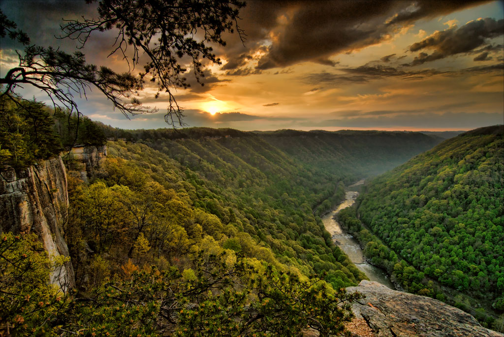
A rugged, whitewater river flowing northward through deep canyons, the New River is among the oldest rivers on the continent. The park encompasses over 70,000 acres of land along the New River, is rich in cultural and natural history, and offers an abundance of scenic and recreational opportunities.
The Park Service's own description.
Weather, in the Park Service's words
Weather in the Appalachian Mountains can be unpredictable and can change quickly. Always be prepared for the possibility of sudden storms. Weather in the mountains is often cooler and wetter than the surrounding area. On average, the warmest month is July. The maximum average precipitation also occurs in July.
Getting there
To reach Park Headquarters take Route 19 North from Beckley to the Glen Jean exit. Upon exiting Rt 19, make an immediate left turn. At the next intersection, turn right. Park Headquarters will be straight ahead on the right. GPS Coordinates for Headquarters: 81.15587W, 37.92775N PLEASE NOTE: Third party search and map apps may direct you to an potentially inaccessible area of the park with no amenities or rangers stations. Please refer to the Visitor Center or Park Headquarters addresses for directions.
Hours
The park itself is open 24 hour a day, year round. The park's two main visitor centers at Canyon Rim and Sandstone are open daily from 9:00 am to 5:00 pm (closed on Thanksgiving, Christmas, and New Years Day). There are two seasonal Visitor Centers located in Thurmond and Grandview. They are typically open Memorial Day to Labor Day.
Current alerts (3)
Information · Burnwood Campground and Restroom Closure
The Burnwood group campground will be closed from October 5 through mid November due to a construction project to replace water lines. During that time restroom facilities will be closed at the Burnwood Trailhead.
Information · Rend Trail Closed through December 2027
The Rend Trail is closed for trail Improvements that will include a new parking area, restroom, and a small picnic area overlooking Arbuckle Creek at the Minden trailhead, structural improvements to five historic railroad trestles along the trail, and full trail surface rehabilit…
Information · Kaymoor Miners Trail Closure
From June 15 through November 19 the upper part of the Kaymoor Miners Trail (from Kaymoor Top down to the mine site at the junction with the Kaymoor Trail) will be closed Monday through Thursday due to a trail rehab project. The trail is expected to be fully open Friday, Saturday…
Camp index at the park
Now 39°F, feels like 37°F; tonight's low about 32°F; UV 0.
- 39°F: cold; a 30°F bag and a pad with real insulation (R-value 3 or more)
- Tonight's low about 32°F: a 20°F bag or warmer
Forecast for the park's reference point; valleys and ridges differ by thousands of feet. How the index works →
Campgrounds in the park (9)
Around the park
Camp set up before "dark by" is the rule most people learn once. Source: sunrise-sunset.org.
- Grandview Playground Shelter · 4 mi · reservable on Recreation.gov
- Grandview Shelter 1 · 4 mi · reservable on Recreation.gov
- Grandview Shelter 4 · 4 mi · reservable on Recreation.gov
- Grandview Shelter 3 · 4 mi · reservable on Recreation.gov
- Grandview Shelter 2 · 4 mi · reservable on Recreation.gov
- BLUESTONE LAKE PICNIC SHELTER · 17 mi · reservable on Recreation.gov
- Bluestone State Park · 18 mi · first come, first served or not reservable online
- BATTLE RUN · 25 mi · reservable on Recreation.gov
Recreation.gov (RIDB): national forests, parks, BLM and Corps of Engineers sites with camping. State parks book through the state; the near-you pages list the rest from OpenStreetMap.
Tents in the shop
All tents → Made in the USA






Park text, alerts, campgrounds and images are the National Park Service's (public domain), fetched through its API; weather from MET Norway, alerts from the NWS, air quality from the EPA, fires from the interagency WFIGS feed, rivers from the USGS, tides from NOAA. Trail & Lantern adds the camp index and nothing else; none of this is safety advice. Check with the ranger station before you go.